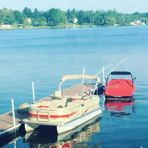
Conneaut Lake
During the last great ice age, Conneaut Lake was formed 12 or so thousand years ago. A 'tongue' of ice went down from the main glacier that had stalled about 15 miles (24km) north near Conneautville, PA. Down the Conneaut Valley, the ice moved until it stopped just south of Town.
The ice melted as the climate warmed, leaving enormous piles of sand and gravel on its southern and eastern berms. These hills are today's sand and gravel banks situated south and east of the Lake. Over the last few thousand years, water from them has blessed the Lake's east side with a sand and gravel bottom.
The glacier also left behind large pieces of itself, buried in the sand and gravel. As they melted, they left huge depressions in the earth, which filled with water and became the prehistoric Conneaut Lake. With time, the extreme northern and southern ends of the Lake were filled with peat and soil, leaving us with a size and shape similar to what we see today. But, by then, people had started visiting the area.
The word 'Conneaut,' used by the area's indigenous people, has as many interpretations as any word you might know. Variously defined as 'snow place, 'snow waters,' 'place where the snow stays,' 'place where the snow stays on the water,' 'snow staying on the water' (you get the idea), it's probably safe to assume it has something to do with snow and water. What the original pronunciation might have been is hard to say. Most folks growing up in the area say 'KON-ee-ought' (bring your tongue to the back of your teeth to abruptly end the word in a glottal stop. That is, don't make the final 't' sound).The northwest portion of the state of Pennslyvania was purchased on October 23, 1784, as part of a treaty with the "Six Nations," that is, the Mohawks, Oneidaes, Onodagoes, Cayugaes, Senecaes, and Tuscororaes tribes of Native Americans, for what amounted to $2,000 (in 1784 dollars). The state intended to set the land aside for veterans of the American Revolution (uh, the War of Colonial Secession).
Abner Evans was not the first Caucasian settler in the area, but he founded a town in 1797 named for himself—Evansburg—on the south end of the Lake. The town was incorporated with that name in 1858 but changed to 'Conneaut Lake' in 1892.
In the 1830s, Conneaut Lake was picked as a water source for the Erie and Beaver Canal. As impressive as it sounds today, a dam was placed across the outlet of the Lake, down near Town, and the Lake was raised nearly ten feet (3.5m) above its present level. This nearly doubled the Lake's area and caused years of mosquito-borne disease until the environment adjusted to the change. The first steamboat appeared on the Lake in the 1860s. Named the 'Wanderer' and owned by Enoch Bartell (Luty, pg 5), it must have been quite a sight chuffing its way across the water.In 1871, the canal closed down. Sometime after, the dam at the outlet was cut, and the Lake assumed its present size. Local folks say the Lake is '3 miles long and a mile and a half wide,' but don't let them fool you. If you measure it on an accurate map, the measurements are 2.7 miles long and 1 mile wide (or 4.4 by 1.6 km). Still, it is Pennsylvania's largest natural lake.
If you really want to start an argument, ask a local about the Lake's deepest point and then move on to its location. Everybody has a favorite depth in a favorite spot, but a fairly detailed survey of the Lake's bottom places the depth at 69 feet (21.3m) about a third of the way across from Shady Dock towards the southern tip of Wolf Island. (D.Hilton & K.Amolsch, 1979). Depths between 60 feet (18.5m) and 120 feet (36.9m) are regularly mentioned, with winning locations off Shady, Oakland, and halfway between Oakland and Lone Tree Point.
In 1881, regular rail passenger service came to the Lake and thus began what some think of as the area's 'golden era.' Over the next 20 years, hotels sprung up around Lake Shore, especially on Lake East Side. Each hotel had its own steamer to haul the growing number of paying customers to and from the rail stations in town. It's hard to believe now, but at one time, nearly a dozen steamboats of varying sizes ran the length of the Lake and stopped at any dock big enough to handle them.And these weren't little boats! Over the next two decades, 40, 60, even 100 feet (33m) long, double-deckers, side wheelers, and dance boats were built or brought to Conneaut Lake. Some names: 'Tuna,' 'Keystone,' 'Fearless,' 'Queen,' 'Nickel Plate,' 'Storm,' 'Swan,' 'Story,' 'Trilby,' 'Conneaut,' 'Iroquois,' 'Marie,' and, the largest of all, the 'Pennsylvania' a double-deck giant that had to watch her way lest she go aground in the shallower waters of the lake. Some of the Lake's oldest residents can still tell first-hand stories about many of these boats.
Around this time, development at the north end of the Lake took off. First, it is called 'Lynce's Landing,' then 'Exposition Park,' and then 'Conneaut Lake Park.' It can get confusing to have so many things with the same name, so most folks go with 'the Lake,' 'the Town,' and 'the Park' and leave it at that. The Park became a destination of its own, with shore-line hotel steamers competing for hundreds of customers.


