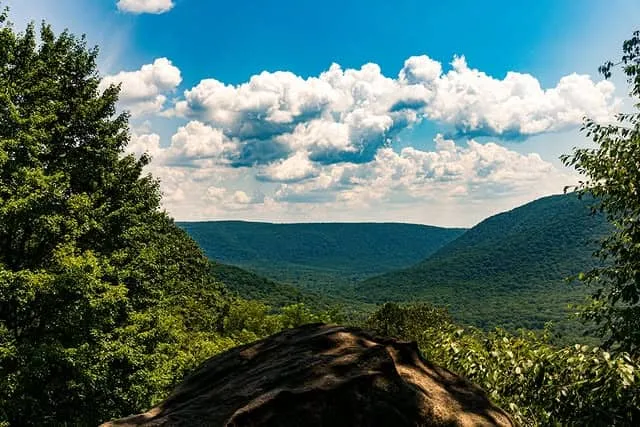
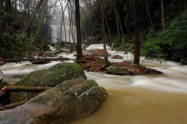
Located primarily in Fayette County, Ohiopyle State Park encompasses approximately 18,719 acres of rugged natural beauty and serves as the gateway to the Laurel Mountains.This area provides parking, a modern comfort station, a gift shop/snack bar, and overlook platforms with magnificent scenery for the eyes or the camera. Other points of interest include Cucumber Falls and the Cucumber Run Ravine which is blanketed with wildflowers and blooming rhododendron.
Opportunities
Whitewater Boating: The park contains two segments of the Youghiogheny River that are used for whitewater boating. The famous lower river begins after the Ohiopyle Falls and contains numerous class III and IV rapids which are run with sturdily constructed rubber rafts, kayaks, and closed deck canoes. The upper section toward Confluence contains class I and II whitewater and is run primarily with open canoes. Four authorized concessionaires provide guided river tours on the lower segment of the Youghiogheny, and canoe and raft rentals are available from private concerns for use on the supper segment of the river. Special regulations are in effect. A separate brochure detailing those regulations applicable to whitewater boating is available upon request.
Interpretive Programs: Both a park naturalist and Visitor Center are available in the park. The park's programs include clinics on such topics as backpacking, cross-country skiing, and snowmobiling; interpretive programs on whitewater boating, area history, nature topics; and guided nature walks. Upon request, the park naturalist is also available to give environmentally oriented programs to groups visiting the park.
Bicycling: Twenty-eight miles of an abandoned railroad right-of-way that parallels the Youghiogheny River between the Ramcat parking area near Confluence and the towns of Connellsvills/Dunbar have been converted to a smooth, hard surfaced trail for bicycling.
The trail features scenic views of the river, cascading feeder streams and a maturing deciduous forest. It is also an excellent area to see many species of wildlife that frequent the park.
This trail is suitable for all ages, and also the handicapped. Rental bicycles are available. The trail is excellent for hiking, jogging and cross-country skiing and can be used to combine a bike ride or hike with some excellent wilderness type trout fishing or hunting.
Hiking: In addition to having the southern terminus of the 70 mile Laurel Highlands Hiking Trail, the park also has more than 41 miles of day hiking trails.
The trails feature impressive rock faces, panoramic views, cascading streams, as well as a diverse sampling of plants and animals native to the area.
Camping: The park campground provides 223 campsites. The area includes washhouses with hot showers, flush toilets, a dumping station for recreational vehicles, a contact station to secure permits and park information, four children's play areas, as well as tent, group tent camping, trailer, and walk-in campsites. Each site is equipped with a firering and picnic table.
Fishing: The Youghiogheny River provides good wilderness trout fishing. Finglering trout are stocked throughout the entire section of river within the park through the cooperation of the Pennsylvania Fish Commission, and the park.
Hunting: Hunters enjoy a fine deer herd as well as turkey, grouse, rabbit, squirrel, and other small game animals throughout the park.
Over 18,000 acres are open to hunting, trapping, and the training of dogs from Labor Day through late May of the following year.
Winter Activities: Snowmobiling, tobogganing, cross-country skiing, sledding, trout fishing, hunting, winter hiking, and backpacking are available to the cold-weather visitor.
Sugarloaf Knob at 2,640 feet above sea level offers 600 acres of meadow land as well as numerous maintained trails for the snowmobiler. There is a parking area with an unloading ramp for trailers. An excellent hill for tobogganing and sledding is located adjacent to the parking area. This area serves as the mountain bike trail head during the warmer months.
The Kentuck and Sproul trails, were designed with cross-country skiers in mind. These trails connect to several hundred acres of meadow that is excellent for skiing. These areas are closed to snowmobiles.
History
Delaware, Shawnee, and Iroquois Indians used the area as a hunting ground. Old records indicate that the name of Ohiopyle was derived from the Indian word "Ohiopehhle" which means "white frothy water", a reference to the large falls on the Youghiogheny River.
It was in this area in 1754 that George Washington, seeking to find a water supply route to help him capture Fort Duquesne, now Pittsburgh, came down the Youghiogheny River, but upon reaching the great falls at Ohiopyle, abandoned his hopes.
In the early 1900s, the Ohiopyle area, particularly Ferncliff Peninsula, was so famous as a summer resort that the Baltimore and Ohio Railroad scheduled Sunday excursion trips from Pittsburgh.
Geologically this area displays examples of mountain forming and erosion processes. The spectacular 1,700 feet deep Youghiogheny Gorge was formed by the Youghiogheny River cutting through Laurel Ridge. A geology brochure offering more information is available from the Park Office.
The Commonwealth acquired most of the park lands in the mid-1960s, and in 1970 the first phase of construction was completed with the development of the "Falls Area".
Return to

